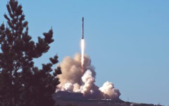
India and the United States are set to launch a landmark space mission today that could revolutionise how we observe the Earth. The NASA-ISRO Synthetic Aperture Radar (NISAR) satellite is scheduled for liftoff at 5:40 PM IST, July 30, 2025, from the Satish Dhawan Space Centre, Sriharikota, aboard an Indian GSLV-F16 rocket. The mission marks one of the most significant collaborations in space history, focused on climate change monitoring, natural disaster prediction, and environmental mapping.
What Is the NISAR Mission?
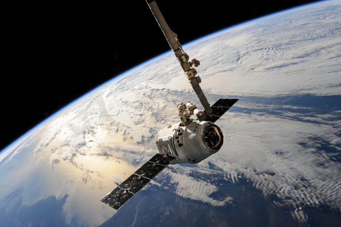
The NASA-ISRO Synthetic Aperture Radar (NISAR) satellite is the world’s first radar imaging satellite designed to scan and map the entire Earth’s surface every 12 days with unprecedented precision. It is jointly developed by NASA (National Aeronautics and Space Administration, USA) and ISRO (Indian Space Research Organisation).
Key Specifications:
- Mission Cost: $1.5 billion USD (approx.)
- Mass: 2,800 kg
- Orbit: Sun-synchronous polar orbit at 747 km altitude
- Technology: Dual-frequency radar (L-band by NASA, S-band by ISRO)
- Lifespan: Minimum 3 years
This dual-band radar technology enables high-resolution imaging of Earth’s surface, even through clouds and dense vegetation, making it ideal for continuous monitoring regardless of weather or time of day.
Why Is NISAR Important?
The NISAR satellite is not just another Earth observer. It’s a crucial tool in tackling climate change, disaster preparedness, and land-use planning. Here’s how:
Climate Monitoring
NISAR will track subtle changes in the Earth’s crust, ice sheets, glaciers, and forests, providing valuable data to detect early signs of climate shifts and sea level rise. This includes mapping ice loss in Antarctica and Greenland, identifying permafrost melting, and tracking carbon stocks in tropical forests.
Earthquake and Landslide Forecasting
The radar interferometry onboard NISAR can detect millimetre-scale ground movements, which are early indicators of earthquake zones, volcanic activity, and landslides. This could drastically improve disaster preparedness worldwide.
Agriculture and Urban Planning
By mapping cropland and soil moisture regularly, NISAR will aid governments in assessing droughts, crop health, and deforestation. Urban planners can also use this data for sustainable development and smart infrastructure.
India’s Role in the Launch
The GSLV-F16 rocket, developed by ISRO, is carrying the satellite into orbit. India contributed the S-band radar, satellite integration, launch services, and the Sriharikota launch facilities. This represents India’s largest partnership with NASA to date.
ISRO Chairman Dr. S. Somanath’s Statement:
“This is a proud moment for India. NISAR puts ISRO among the top tier of space-faring nations contributing to global environmental stewardship.”
NASA’s Role and Scientific Vision
NASA designed the L-band radar, which can penetrate deeper through vegetation and surface layers, making it key to forest biomass and wetland mapping. NISAR’s data will be processed and distributed freely for scientists globally.
NASA Administrator Bill Nelson:
“NISAR is one of the most important Earth science missions ever. It represents how space partnerships can address challenges faced by all humanity.”
How to Watch the Launch Live
The NISAR launch will be livestreamed by both NASA and ISRO on their official YouTube channels and websites. Coverage begins at 5:00 PM IST, with the launch window set at 5:40 PM IST.
- NASA Live: youtube.com/nasa
- ISRO Live: isro.gov.in
Implications for the UK and Global Communities
The United Kingdom, being highly committed to environmental sustainability and climate monitoring, stands to benefit immensely from NISAR’s open data policy. UK-based research institutions and agencies like the UK Met Office, Environment Agency, and DEFRA can use NISAR data for:
- Flood risk mapping
- Agricultural monitoring
- Coastal erosion analysis
- Urban development planning
Previous Collaborations Between NASA and ISRO
NISAR isn’t the first India-US space partnership, but it is by far the most technologically sophisticated. Past collaborations include:
- Megha-Tropiques (climate monitoring)
- SARAL (altimetry satellite)
- Mars Orbiter Mission support
However, NISAR sets a new benchmark with its scale, cost, and scientific impact.
Post-Launch Timeline and Deployment
If successful, the launch will be followed by several phases:
- Orbit Insertion – Within 20 minutes of launch
- Solar Array Deployment – Within the first hour
- Radar Calibration – Over the next 3–6 months
- Data Release – Publicly accessible by early 2026
The satellite’s data will be stored and distributed through platforms like NASA’s Earthdata, ISRO’s Bhuvan, and Open Science Earth portals.
Final Thoughts
The successful launch of the NISAR satellite today is a historic leap in global climate and disaster science. It reflects not just technological prowess, but international cooperation at its finest. With data openly available to researchers, governments, and humanitarian agencies, NISAR stands to transform how humanity responds to some of its most urgent challenges—from melting glaciers to megacities sinking. For India, it’s a powerful endorsement of its growing capability in space science. For the world, it’s a new lens on a changing planet.
FAQs
1. What is the purpose of the NISAR satellite?
It’s designed to monitor Earth’s surface changes to help with climate analysis, disaster forecasting, agriculture, and more.
2. Who built the NISAR satellite?
NISAR was co-developed by NASA (USA) and ISRO (India) with a combined investment of over $1.5 billion.
3. How often will NISAR scan the Earth?
Every 12 days, it will map the entire globe with radar imaging that can detect millimetre-scale changes.
4. How can I access NISAR’s data?
Data will be publicly available via NASA Earthdata, ISRO Bhuvan, and other global portals from early 2026.
5. Why is this important for the UK?
UK scientists and government agencies can use the data for environmental monitoring, agriculture, and disaster management.
Resources & References
- NASA Official NISAR Page
- ISRO Official Mission Portal
- Times of India – Launch Coverage
- AP News – Mission Context
- NASA Live
Disclaimer
The information in this article is based on verified sources as of July 30, 2025. Any live events or future mission milestones may change depending on real-time mission control decisions by ISRO or NASA. The Breadline Bulletin is not responsible for live-stream availability or official mission timings.
SEO Meta Information
SEO Title: NASA-ISRO Launch NISAR Satellite Today
Slug: nasa-isro-nisar-launch-2025
Meta Description: NASA and ISRO launch the world’s most advanced Earth-mapping satellite NISAR today from Sriharikota. Here’s what it means.